Nanga Parbat Trekkingkarte 1 : 50’000 DAV Karte 0/7
CHF 33.00 incl. MwSt.
out of print
SKU: 200168
Category: Maps
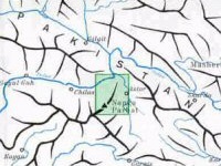
Nachdruck der Landkarte der Deutschen Himalaya-Expedition 1934
Deutscher/Österreichischen Alpenverein. 1936 (redone in 1980). A superb
topographic map of this region near Gilgit, centered on the 6800 meter Chongra
Peak.
| Region | |
|---|---|
| Erscheinungsjahr | |
| Sprache | |
| Autor |
Recommendations on the topic
Video/ DVD/ Multimedia
Nanga Parbat, der tödliche Berg – Nanga Parbat, la montagne tueuse DVD
CHF 31.00 incl. MwSt.
Guidebooks Alpine Summer
CHF 46.50 incl. MwSt.
CHF 79.60 incl. MwSt.
Documentations
CHF 19.50 incl. MwSt.
Documentations
CHF 21.90 incl. MwSt.
Documentations
CHF 29.80 incl. MwSt.
Video/ DVD/ Multimedia
CHF 43.20 incl. MwSt.
Documentations
CHF 34.70 incl. MwSt.


