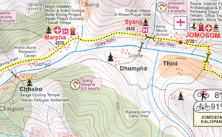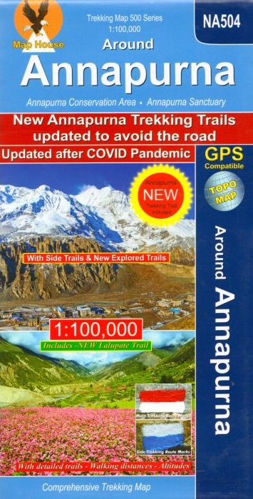
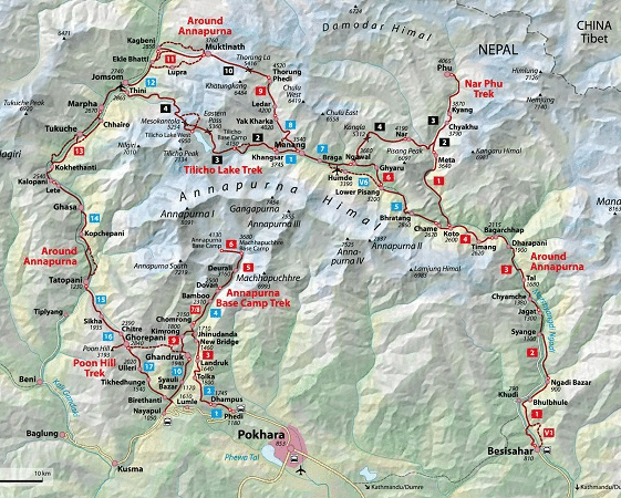
Around Annapurna 1:100`000 – sheet NA504
CHF 25.60 incl. MwSt.
Marsyangdi, Thorung Pass, Kali Gandaki
Detailed 1:100,000 scale map of the whole Annapurna circuit, including
information on recenlty opened routes. Going from a height of 800m to 5500m
this map covers the 9-21 day route. The route goes via Besi Sahar, Chame,
Manang, Ledar, Thorung La, Muktinath, Tatopani, Beni, Pokhara.
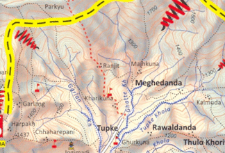
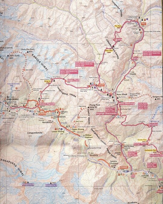
The whole of the Annapurna Circuit highlighted on a map at 1:100,000 from Nepa Maps, with alternative variants via the Tilicho Lakes or Naar, treks to the Machhapuchhre and South Annapurna Base Camps, climbing routes to the Chulu Peaks, Pisang Peak and Singu Chuli (Fluted Peak), etc. Coverage extends from Pohkara to Muktinath and Kagbeni in the north, and in the north east includes the route to Phugaon and the trek/climb to Himlung. Contours are at 80m intervals. The index lists settlements, peaks, passes and lakes. Margin ticks give latitude and longitude at 5? intervals. Additional information includes a profile of the route and tables showing the route and its variants in stage with altitudes in metres and feet, plus trekking times.
Recommendations on the topic


Maps

Hiking / Trekking Guidebooks