BRABANT ISLAND TO ARGENTINE ISLANDS Scale 1:250’000
CHF 35.30 inkl. MwSt.
Vergriffen
BAS/ UKAHT Sheet 2
A section of the northern part of the Antarctic Peninsula with the nearby
islands, including Brabant Island and Anvers Island (the location of the US
Palmer Station), on a contoured topographic map at 1:250,000 published by the
British Antarctic Survey and the United Kingdom Antarctic Heritage Trust in
2008.
The map provides a vivid presentation of the terrain characteristic of BAS’s
topographic mapping and shows permanent and summer-only research stations, as
well as locations of historic sites/monuments and Antarctic Specially
Protected Areas with their HSM and ASPA numbers. Full BAS ref for this title
is: Series BAS (UKAHT) sheet 2; folded.
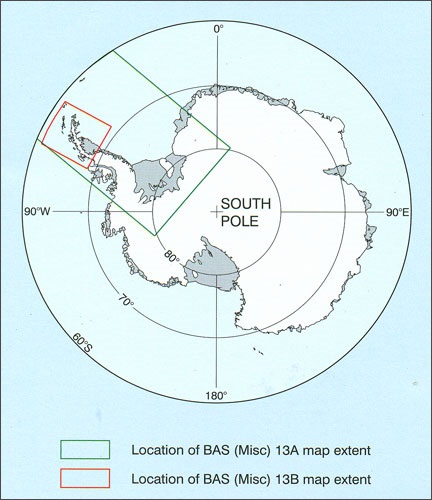
The map covers the area of the west coast of the Antarctic Peninsula between
Brabant Island and the Argentine Islands, including: Gerlache Strait; Lemaire
Channel; Palmer Station; Vernadsky Station and Port Lockroy Historic Site. It
also covers part of the east coast including Exasperation Inlet and Crane
Glacier. It connects to map BAS/UKAHT 3 to give full coverage of the northern
Antarctic Peninsula north of the Argentine Islands.
The map shows topographic detail with a Landsat ETM+ satellite image mosaic
backdrop. It includes coastline; elevation information as contours and
selected mountain summit heights; UK place-names; scientific research
stations; Historic Sites and Monuments (HSMs) and Antarctic Specially
Protected Areas (ASPAs).
| Region | |
|---|---|
| Erscheinungsjahr | |
| Sprache | |
| Autor |
Empfehlungen zum Thema
Landkarten
Sachbücher/ Dokumentationen


