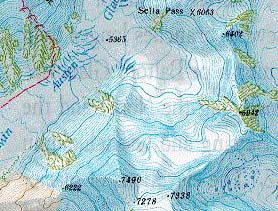
Kangrinboqe (Mt. Kailash)1: 100 000
CHF 34.30 inkl. MwSt.
Artikelnummer: 202000
Kategorie: Landkarten
Landkarte des Langzhou Institute of Glaziology mit englischer Kurzeinführung
in das Ngari Gebiet in Tibet: shows more than 60 virgin mountains above 6000 m
A. S. L.
These English-language maps, produced by a cartographer/geographer in Xi’an,
offer superb topographic detail and descriptive text of major peaks such as
Mt. Everest, K2, and several others. Contour interval is typically 40 meters;
superb topographic maps of major mountain peaks in China.
| Region | |
|---|---|
| Erscheinungsjahr | |
| Sprache | |
| Autor |
Empfehlungen zum Thema
Sachbücher/ Dokumentationen
CHF 25.90 inkl. MwSt.
Landkarten
CHF 20.90 inkl. MwSt.
Kunst/Kultur
CHF 51.00 inkl. MwSt.
Sachbücher/ Dokumentationen
CHF 34.90 inkl. MwSt.
Sachbücher/ Dokumentationen
CHF 42.30 inkl. MwSt.
Sachbücher/ Dokumentationen
CHF 26.90 inkl. MwSt.
